
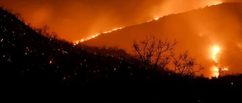
A new study titled “Changing fire regimes in wildlife reserves of southern India: Trends, drivers, and conservation challenges,” published in the journal Ecosphere on 19th October 2026, provides the first detailed analysis of how wildfires are changing across three major forested regions of peninsular India.
Over two decades of the study period, approximately 16,667 square kilometers burned across the 13 reserves, reflecting that some areas burned more than once over the two decades. Fire activity increased significantly in the Eastern Ghats, by about 9 percent a year, and rose more modestly in Central India. In contrast, the Western Ghats recorded a statistically significant decline of about 11 percent a year. Because this decline was concentrated in one region, it had been obscured in earlier estimates that combined all three regions into a single national trend.
The scientists analyzed satellite-derived burned area data from NASA’s MODIS sensor, covering 2002 to 2022 across roughly 20,000 square kilometers of protected forest in Central India, the Eastern Ghats, and the Western Ghats. They combined this with climate records, including measures of drought and temperature, along with human population density and forest cover loss data, then used statistical models to identify which climate and human factors were most closely associated with year-to-year changes in burned area in each reserve.
Climate and human factors explained between 21 and 77 percent of annual fire activity across reserves. Drought conditions, measured through indicators such as climatic water deficit and the Palmer Drought Severity Index, were the primary driver of fire activity in most reserves. Human population density was also strongly associated with more frequent fires in Kawal Wildlife Sanctuary and Nagarjunasagar-Srisailam Tiger Reserve, where local communities use fire to help harvest forest products or improve grazing land. In Nagarahole and Bandipur National Parks, by contrast, human activity was linked to less fire, which the authors attribute to land-use change and active fire suppression by forest departments.
The authors note that separate research ranked the Eastern Ghats among the five most extreme wildfire events recorded globally during the 2023-2024 fire season, highlighting the scale of the changes documented in this study. Fire in these landscapes is closely tied to how communities use forest resources. In Kawal Wildlife Sanctuary, people use fire to help harvest mahua (Madhuca indica) flowers and tendu (Diospyros melanoxylon) leaves.
The study was led by Dr. Narendran Kodandapani, Principal wildlife scientist at Centre for Wildlife Studies and co-authored by Dr. Krithi K. Karanth (Chief Executive Officer, Centre for Wildlife Studies; Nicholas School of the Environment, Duke University), who emphasize that effective responses will require moving beyond reactive firefighting toward proactive, climate-informed land management, especially in Indian savanna forest systems. This means investing in early warning systems that track drought indicators in real time, building capacity among forest departments and local communities to respond to shifting fire seasons, and developing national fire policies that are grounded in regional ecological realities rather than uniform rules.
Wildfire activity is accelerating in some parts of the world and declining in others, and scientists do not yet fully understand why. India holds four of the world’s 34 recognized biodiversity hotspots, and fire shapes the forests and grasslands that support much of its wildlife. Yet long-term data on how Indian fire regimes are changing has been limited. This study examined fire activity across 13 wildlife reserves in three ecologically distinct regions of southern India to understand how climate and human activity are together shaping when, where, and how often these landscapes burn.
As climate change continues to intensify drought conditions and extend dry seasons across the Indian subcontinent, the findings of this study suggest that the combination of heat, low humidity, and dry winds that makes landscapes vulnerable to burning, will become more frequent in the coming decades. In regions such as the Eastern Ghats and Central India, where fire activity is already increasing sharply, this could push ecosystems toward ecological tipping points from which recovery is slow and uncertain. For the Western Ghats, where fire suppression is driving a different set of risks, the challenge could fundamentally alter habitats that support tigers, elephants, and hundreds of endemic species.
In the Eastern Ghats and Central India, intensifying fires during drought years are pushing ecosystems toward fire-tolerant grasses such as Cymbopogon and creating regeneration challenges for native trees. In the Western Ghats, declining fire activity risks allowing woody plants to encroach on the open grasslands that support herbivores, and in turn the Asian elephant (Elephas maximus) and Bengal tiger (Panthera tigris), both of which reach their highest densities in the region. The authors suggest that blanket approaches to fire management, whether uniform suppression or uniform burning should be avoided. Instead, they call for region-specific strategies that combine climate monitoring, early-warning systems for drought conditions, and recognition of the traditional burning practices used by communities living alongside these reserves.
The researchers added: “Globally, the intensity and scale of wildfires are growing, India is no exception. Fire management needs to transition to plan forward using science, on ground- knowledge and technological advancesGlobally, wildfires are increasing in intensity and scale, and India is no exception. Fire management must evolve from reactive responses to proactive, science-based planning that integrates on-the-ground knowledge with advances in technology.”